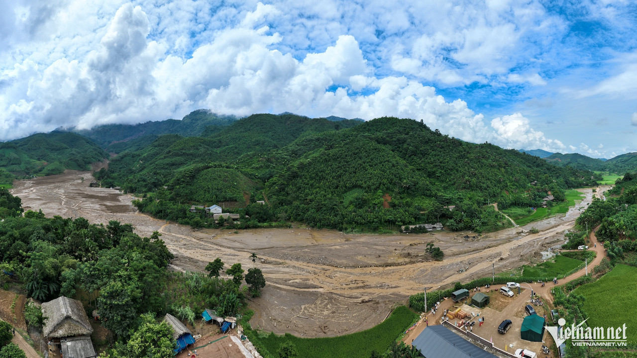
Scientists have confirmed that a mud-rock flash flood was responsible for the disaster in Nu Village. In just five minutes, 1.6 million cubic meters of mud, rocks, and water poured down from the mountains, burying the village.

On the morning of October 2, the Geology Department of the University of Natural Sciences (Vietnam National University, Hanoi) held a scientific seminar titled "The Nu Village Disaster – Causes and Prevention Measures."
At the seminar, Associate Professor Dr. Nguyen Chau Lan, Deputy Head of the Geotechnical Department at the University of Transport, explained that, following the disaster in Nu Village (Bao Yen, Lao Cai province), Professor Tran Thanh Ha, Rector of the University of Mining and Geology, along with a team of scientists, visited the site to collect data in key areas of Lao Cai Province.
“Our initial findings indicate that the cause of the Lang Nu disaster was a mud-rock flash flood. Around 1.6 million cubic meters of mud, rocks, and water descended from the peak of Con Voi Mountain, located 3.6 km from Nu Village,” Lan reported.
The flash flood, which struck on the morning of September 10, completely buried Nu Village, home to 37 households with 158 residents. As of now, 58 people have been confirmed dead, with nine still missing.

As the torrent of debris descended, it became blocked in a narrow area just 100 meters wide, located 2 km from the initial landslide point. This natural dam significantly increased the risk of a catastrophic flood release.
At the time of the disaster, the area experienced extremely heavy rainfall, with a total accumulation of 633 mm and hourly rainfall peaking at 57 mm, accelerating the flow of the mud and rocks.
After inputting the data into a model, Lan found that the depth of the accumulated mud flow ranged from 8 to 15 meters, with the deepest point reaching 18 meters. The flow traveled at a speed of up to 20 meters per second, taking just five minutes to cover the 3.6 km distance from the mountain to the village.
Lan further explained that in Bao Khanh Commune, rainfall accumulation on September 9 reached 500 mm. This suggests that initial landslides on Con Voi (Elephant) Mountain may have started on September 9, although villagers in Nu Village did not anticipate the mud-rock flash flood.
"The location of Nu Village is situated on a geological fault line, making it particularly vulnerable to geological hazards. Local authorities should advise residents against building homes in such dangerous areas," Lan emphasized.
Lan also noted that this type of mud-rock flood is not a rare phenomenon and has occurred in many parts of the world, including a disaster in Seoul, South Korea, in 2011.
Residents advised against building near streams

To prevent future disasters, scientists recommended that residents avoid constructing homes near streams or in landslide-prone areas.
Currently, several northern provinces, including Ha Giang and Lao Cai, are showing signs of geological fissures, giving authorities time to take preventive action.
One immediate solution is to cover the cracks with tarpaulin and install lateral drainage systems to prevent water from seeping into the ground, reducing the risk of landslides.
“This is a simple measure that localities can quickly implement before employing more technical solutions to address the fissures,” Lan suggested.
Associate Professor Dr. Do Minh Duc from the University of Natural Sciences noted that early detection of landslide risks, even a few minutes or seconds in advance, could save lives. Therefore, early warning systems and prompt action are crucial.
Duc proposed establishing a comprehensive database and mapping system to identify high-risk areas, particularly focusing on different types of landslides and flash floods.
Additionally, rainfall is the primary trigger for landslides, so key areas should have at least one rain gauge station to provide timely warnings.
N. Huyen