 Vietnamnet.vn

 Podcast



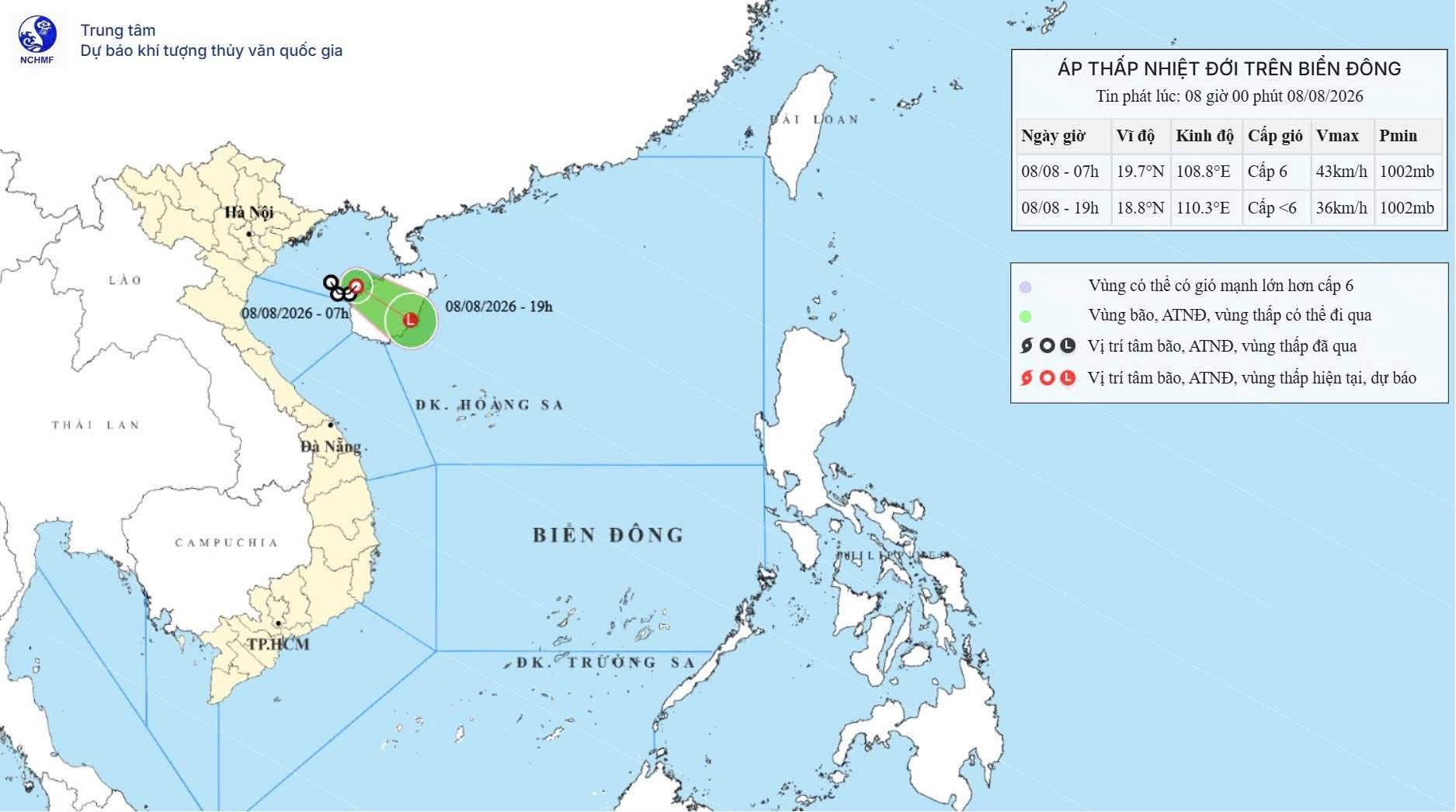
According to Vietnam’s National Center for Hydro-Meteorological Forecasting, at 7am on August 8, the centre of the tropical depression was located at around 19.7 degrees north latitude and 108.8 degrees east longitude, over the eastern waters of the Gulf of Tonkin.
Maximum sustained winds near the centre were at level 6, equivalent to 39-49km/h, with gusts reaching level 8.
The tropical depression continues to move slowly east-southeast at around 5-10km/h. Since developing from a low-pressure area over the Gulf of Tonkin on the morning of August 7, the system has moved relatively little, maintaining a speed of only around 5-10km/h.
Over the next 12 hours, the depression is forecast to continue moving east-southeast at about 10km/h while gradually weakening into a low-pressure area.
By 7pm on August 8, the low-pressure area is expected to be southeast of Hainan Island, China, with winds weakening to below level 6.
Meteorological authorities warned that the tropical depression will bring level 6 winds, gusting to level 8, across the Gulf of Tonkin. Waves are forecast to reach 1.5-2.5 metres, with rough seas.
Across the northern and central parts of the East Sea, including the Hoang Sa Special Zone, winds are expected to reach level 6 and occasionally level 7, with gusts of level 8. Waves could reach 2-4 metres, producing very rough seas.
Vessels operating in these hazardous waters could be affected by thunderstorms, tornadoes, strong winds and high waves.
“The tropical depression is unlikely to strengthen into a storm and is not expected to make landfall in Vietnam,” the meteorological agency said.
Bao Anh
.svg)
