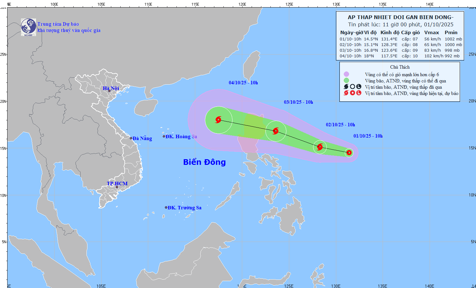
Forecasts for the next 24 hours indicate the depression will continue on a west-northwest path at 15 km/h and is likely to strengthen into a storm.
By 10 a.m. on October 2, the storm’s center is expected to remain over the eastern waters of Luzon Island, reaching intensity level 8 with gusts up to level 10.
Over the following 24 hours, the system will maintain its direction, accelerate to 20-25 km/h, and is expected to intensify further.
By 10 a.m. on October 3, it will still be located east of Luzon, with maximum sustained winds increasing to level 9, gusting up to level 11.
Between 48 to 72 hours from now, the storm will continue moving west-northwest at 25-30 km/h, entering the East Sea and potentially gaining strength.
If it enters the East Sea, it will become the 11th named storm to affect the region in 2025.
Due to the storm's influence, starting from October 3, the eastern part of the northern East Sea will experience strong winds reaching level 6-7, and level 8 near the center, with gusts up to level 10. Wave heights will range from 2.5 to 4.5 meters, and sea conditions will be rough.
Notably, from October 4 to 6, the northern East Sea (including the Paracel Islands) could be affected by winds of level 10-11, with gusts up to level 14.
Vessels operating in these hazardous areas may face thunderstorms, strong winds, and rough seas.
Bao Anh
