Tropical Storm Mekkhala developed from a tropical depression over the northwestern Pacific Ocean and is expected to continue strengthening over the next several days. Current forecasts indicate the storm could reach maximum sustained winds of force 12, with gusts up to force 16. At present, there are no signs that the storm will enter Vietnam’s East Sea.
On the afternoon of June 20, Vietnam’s National Center for Hydro-Meteorological Forecasting issued an updated forecast on the storm’s projected path. Earlier that morning, the tropical depression intensified into a named tropical storm, receiving the international name Mekkhala.
Mekkhala is the seventh storm to form in the northwestern Pacific basin this year.
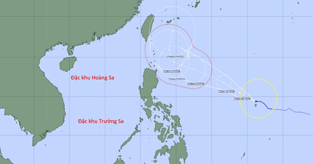
As of 4 p.m. local time, the center of the storm was located near 14.4 degrees north latitude and 136.2 degrees east longitude. The storm was carrying sustained winds of force 8, with gusts reaching force 11.
At that time, Mekkhala was still approximately 2,000 kilometers east of the Philippines.
Forecasters expect the storm to move west-northwest over the next 24 hours while continuing to intensify. It is forecast to reach force 12 intensity, with gusts up to force 16.
Around June 24, as the storm approaches the northern part of Luzon Island in the Philippines, it is expected to turn northward, heading toward waters east of Taiwan and the southeastern maritime region of Japan.
“There are currently no indications that Storm Mekkhala will move into Vietnam’s East Sea. Vietnamese meteorological authorities are continuing to closely monitor its development,” the National Center for Hydro-Meteorological Forecasting said.
Bao Anh