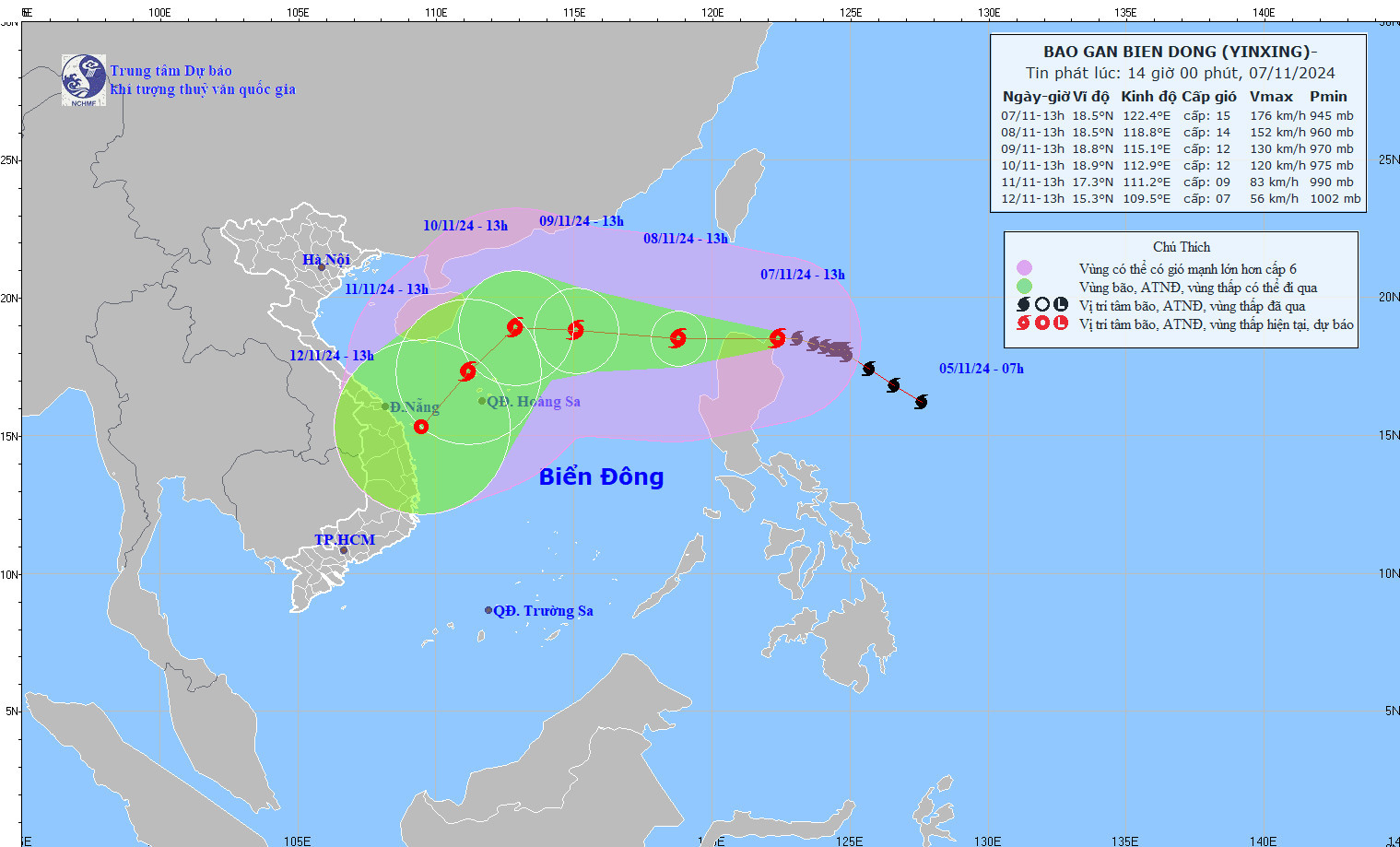
Typhoon Yinxing has reached its peak intensity, with sustained winds of Category 15 (167-183 km/h) and gusts exceeding Category 17.
The storm is moving west-northwest and is expected to enter the East Sea by the morning of November 8, becoming the seventh storm of the season as it slightly weakens.
According to the National Center for Hydro-Meteorological Forecasting, as of 1:00 PM today (November 7), Yinxing’s center was located over the northeastern waters near Luzon Island, Philippines. The storm is currently moving at a speed of 10-15 km/h.
Over the next 24 hours, Yinxing is expected to shift westward, accelerating to 15-20 km/h as it enters the East Sea. By 1:00 PM tomorrow (November 8), the storm’s center will be over the eastern waters of the northern East Sea. At this point, Yinxing is forecasted to weaken slightly to Category 14, though gusts will remain above Category 17.
As it moves toward the Hoang Sa (Paracel) Islands, the storm’s path is expected to shift multiple times, with a general trend toward weakening.
From 72 to 120 hours, Yinxing may alter its course southwestward, moving at a speed of 10-15 km/h with further intensity reduction.
Due to Yinxing's influence, the eastern East Sea will experience strong winds ranging from Category 6-7, intensifying from tonight to Category 8-11. Areas near the storm's center could see winds of Category 12-14, with gusts reaching Category 17. Waves are expected to reach 4-6 meters, with heights of 6-8 meters near the storm’s center, resulting in extremely rough seas.
All vessels operating in these areas are at risk from thunderstorms, strong winds, and high waves.
Bao Anh