The Ministry of Agriculture and Environment, in coordination with the Hanoi People’s Committee, has agreed on a phased plan to relocate and reorganize all residential areas located outside the Red River dike system. The move is part of a broader effort to comprehensively redevelop both sides of the river in alignment with the capital’s long-term development vision over the next 100 years.
The conclusion follows a joint meeting focused on hydraulic calculations and flood drainage safety for the Red River section linked to the proposed Scenic Boulevard Project.
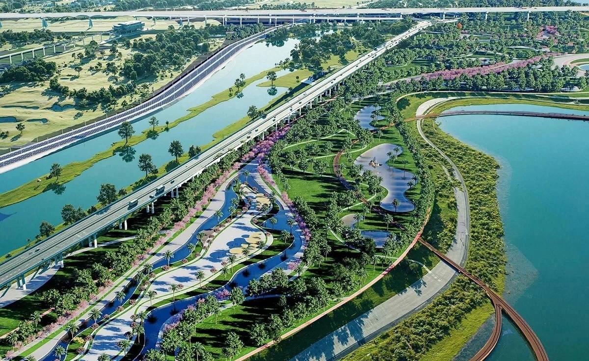
Forming a strategic green axis along the Red River
According to the agreement, both the ministry and Hanoi authorities have largely endorsed the investor’s proposal to adjust the overall zoning plan for the Red River urban area.
The revised plan suggests increasing the proportion and scale of construction land in the riverbank zones to better meet urban development and strategic infrastructure objectives.
In particular, the scenic boulevard stretching from Hong Ha Bridge to Me So Bridge is envisioned as a strategic axis for the capital. It will serve as a central green corridor, as well as an economic, commercial, and service hub, fostering innovative urban development tied to science and technology along both riverbanks.
Functional agencies have assessed that the adjusted plan aligns with Hanoi’s master plan for the next century while also meeting existing flood prevention standards under current dike system regulations.
Studying water-regulating dams on the Red River and Duong River
Both sides have agreed on an approach that prioritizes flood discharge space and safety, based on comprehensive hydraulic modeling that accounts for hydrology, water flow, and design elevations.
Notably, the project will incorporate solutions to regulate Red River water levels in both flood and dry seasons.
The Red River will be considered within the broader network of rivers flowing through Hanoi, allowing for coordinated measures to restore and manage waterways such as the Tich, Nhue, and Day rivers.
Authorities will continue studying the feasibility of constructing water-regulating dams on the Red River near Pho Hien and on the Duong River downstream of Long Tuu.
Preserving traditional craft villages within a new urban structure
The conclusion also emphasizes that Hanoi will gradually relocate, reorganize, and replan all residential areas outside the dikes to meet the requirements of a comprehensive and synchronized redevelopment of both riverbanks.
However, traditional craft villages such as Bat Trang pottery, Kim Lan, Van Duc, and the Nhat Tan peach blossom area will be preserved and revitalized within the new urban framework.
The orientation focuses on conserving these villages in connection with cultural spaces, experiential tourism, and themed parks. At the same time, it seeks to redesign residential areas, upgrade technical infrastructure, and promote creative economic development rooted in local identity.
Authorities have also called for further refinement of planning and architectural designs to account for worst-case scenarios involving climate change, major storms, and extreme weather events.
All calculations will be based on a comprehensive approach to flood safety, irrigation, and dike systems, ensuring compatibility with construction density and urban development along both sides of the Red River.
Vu Diep