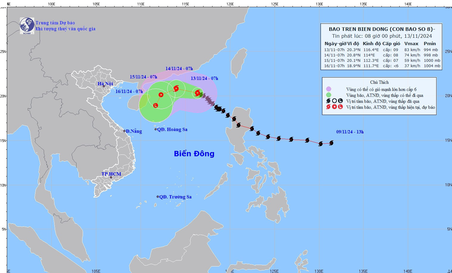
The National Center for Hydro-Meteorological Forecasting reported that as of 7 a.m. on November 13, the center of Typhoon No. 8 was located at approximately 20.3°N latitude and 116.4°E longitude, over the northeastern part of the North East Sea.

The strongest winds near the storm's center were at levels 8-9 (62-88 km/h), with gusts up to level 11, moving northwestward at a speed of 10-15 km/h.
Meteorologists predict that Typhoon No. 8 will bring strong winds and large waves to the sea: winds of levels 6-7 over the northern waters of the North East Sea, and levels 8-9 with gusts up to level 11 near the storm’s center, producing waves 3-5 meters high, and 5-7 meters near the storm’s center. These conditions will result in very rough seas.
Vessels operating in the dangerous zones may experience severe weather, including thunderstorms, strong winds, and high waves.
Additionally, according to the latest update from the Japan Meteorological Agency (JMA), Typhoons Usagi and Man-yi are both active in succession and are forecast to affect the Philippines, with potential movement into the East Sea.
Ly Dao