According to the National Center for Hydro-Meteorological Forecasting, two widespread rounds of showers and thunderstorms affected the region during this period. The first occurred from the morning to midday of March 29, followed by a stronger system beginning around 1:00 a.m. on March 30 and lasting until approximately 7:00-8:00 a.m.
Heavy rainfall was recorded in several areas, with some stations exceeding 50mm. Notable figures included 72.4mm in Ben Tam (Hai Phong), 70.4mm in Co Phap (Bac Ninh) and 54.3mm in Buoi (Hanoi).
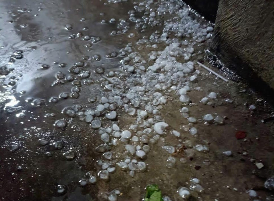
Hail was also reported in localities such as Hanoi, Lao Cai, Phu Tho and Son La, contributing to both human casualties and property damage. These events are typical during the seasonal transition from spring to summer, driven by the interaction between hot and cold air masses and intensified westerly winds at altitudes of 3,000 to 5,000 meters.
Mai Van Khiem, Director of the National Center for Hydro-Meteorological Forecasting, said the recent storms followed expected seasonal patterns. The collision between a hot air mass affecting the western regions and a weak cold air mass moving in from the north created strong convective clouds, leading to tornado-like winds, lightning and hail.
Following the storms, northern Vietnam is expected to experience a brief spell of early-season heat. On March 30-31, temperatures in the northwest and from Thanh Hoa to Hue may reach 35-38 degrees Celsius. Hanoi and northeastern provinces could see localized heat on March 30, expanding more widely on March 31.
From the night of March 31 into April 1, however, a weak cold air mass is forecast to move in, bringing cooler conditions. Between April 1 and 2, temperatures are expected to drop, with cooler weather in lowland areas and chilly conditions in mountainous regions.
Meteorologists warn that this transition period will likely trigger further instability. The interaction between residual heat and incoming cold air may lead to additional thunderstorms in northern mountainous areas and parts of north-central Vietnam, accompanied by risks of strong winds, lightning, hail and gusts.
These weather phenomena can develop rapidly and unpredictably, posing dangers such as roof damage, falling trees and threats to human life and livelihoods.
Preliminary reports from provinces including Lao Cai, Cao Bang, Quang Ninh, Lang Son, Tuyen Quang, Phu Tho, Thai Nguyen, Son La and Hanoi indicate significant human and material losses. Four fatalities were recorded - one in Tuyen Quang and one in Son La due to lightning strikes, and two in Quang Ninh after strong winds capsized a boat. Nine people were injured across multiple localities.
The storms also destroyed 13 houses and damaged 6,551 others, primarily through roof loss. Agricultural losses included 35 hectares of rice, 181.8 hectares of crops and fruit trees, and 68.1 hectares of forestry plantations, while 1,280 poultry were killed.
Additionally, 172 auxiliary structures, 22 cultural houses, three government offices and 21 power poles were damaged or destroyed. Two transformer stations in Hanoi were also affected.
Local authorities have mobilized forces to support affected communities, assist families of victims and begin recovery efforts. Damage assessments are ongoing as officials continue to monitor the evolving weather situation.
Bao Anh