 Vietnamnet.vn

 Podcast



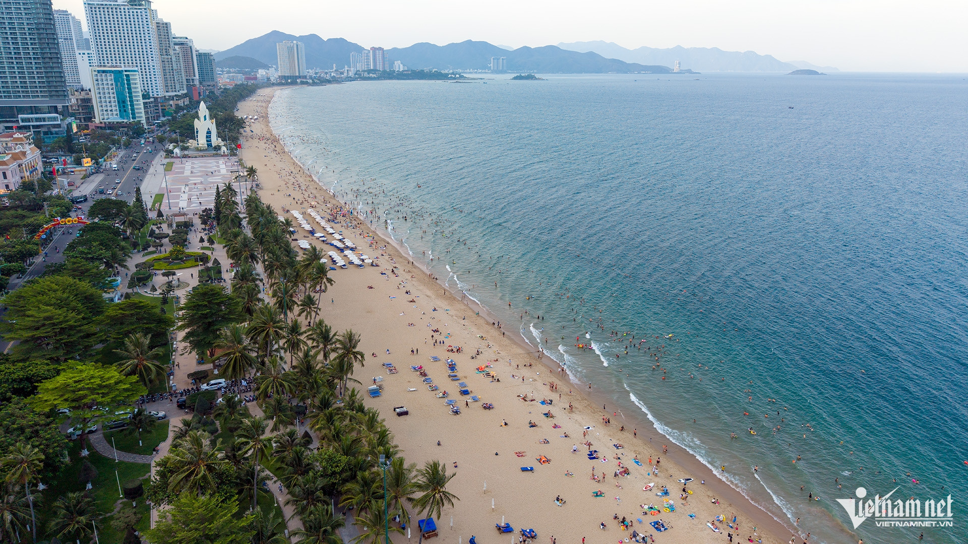
Authorities in Nha Trang, Khanh Hoa Province, have unveiled a new detailed urban plan for the eastern side of Tran Phu Street, the city's iconic beachfront boulevard, aimed at expanding public space, improving access to the beach and tightening development controls along the coast.
The 1:500-scale master plan, announced on July 7 by the Nha Trang Ward People's Committee, covers the section from Tran Phu Bridge to Nha Trang Port.
Encompassing approximately 80.6 hectares, the project will be implemented in two phases, with targets set for 2030 and a longer-term vision extending to 2040.
The plan translates the former Nha Trang City's master plan into detailed zoning regulations while providing a framework for land management, architecture, infrastructure development and investment.
Public space takes priority
Under the new plan, authorities are prioritizing public amenities over increased construction density in one of Nha Trang's most valuable tourism and commercial areas.
More than 275,500 square meters - about 34.2% of the planning area - has been allocated to public parks and green space.
The blueprint also includes: More than 32,300 square meters of public plazas; More than 97,200 square meters of sandy beach; Nearly 221,500 square meters designated for transport infrastructure.
A continuous beachfront park system will link residential neighborhoods, tourism facilities and existing attractions, creating an uninterrupted public waterfront for residents and visitors.
Low-rise service facilities - including rest areas, public toilets, shelters and tourism support amenities - will be permitted within the parks. However, these structures must maintain low building density and limited floor-area ratios to preserve sea views and the continuity of the coastal greenbelt.
The master plan also calls for new public squares, scenic cycling routes along the coast, cultural and artistic spaces, marine heritage attractions and outdoor recreational areas to strengthen Nha Trang's tourism appeal while expanding community gathering spaces.
Improved connectivity Tran Phu Street will remain the city's principal coastal artery, while the internal road network will be upgraded to improve links between different functional zones.
The plan includes 13 parking facilities, comprising: Nine parking areas within coastal parks; One parking lot identified under the district zoning plan; Three underground parking garages.
Authorities are also studying the construction of three pedestrian underpasses near Havana Hotel, Yersin Park and Thanh Nien Square.
Pedestrian bridges across Tran Phu Street and several other roads are also encouraged to improve connectivity between residential neighborhoods and the beach while enhancing traffic safety, particularly during the peak tourism season.
Building height limits
During the first phase through 2030, authorities will focus on upgrading existing residential areas, developing public parks, improving transport and technical infrastructure, and completing investment procedures.
Development will continue after 2030 in accordance with the approved master plan.
The new regulations establish building height limits based on land use.
Private homes may be built to a maximum of six stories, while government buildings and commercial service facilities will be limited to 20 stories.
Mixed-use residential developments and tourism service projects may reach 40 stories, depending on the specific planning zone and compliance with applicable construction standards.
For cultural, religious and heritage sites, the plan requires preservation of their historical and architectural values while minimizing alterations that could affect the surrounding landscape.
Architectural design competitions will also be required for landmark structures located along the beachfront and at key gateways to create distinctive urban features for Nha Trang.
Xuan Ngoc
.svg)
