 Vietnamnet.vn

 Podcast



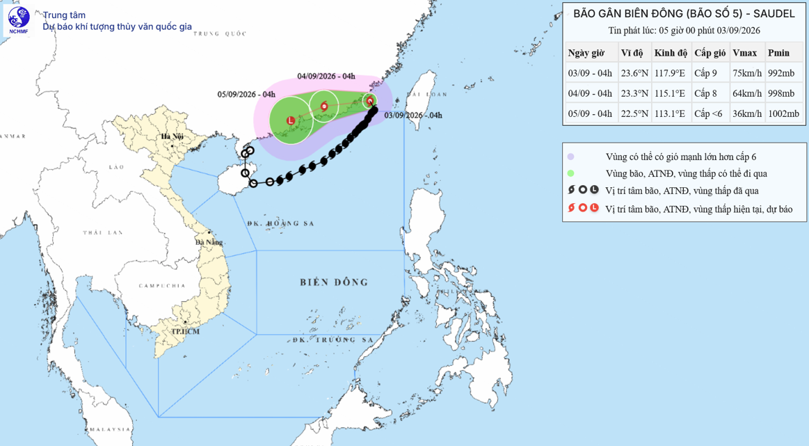
According to the National Center for Hydro-Meteorological Forecasting, at 4 a.m. on Sept. 3, the center of Saudel was located at around 23.6 degrees north latitude and 117.9 degrees east longitude, over waters southeast of Fujian Province, China.
Maximum sustained winds near the storm’s center were at force 8-9, or 62-88 kph, with gusts reaching force 11. The storm was moving west-northwest at around 10 kph.
Over the next 24 hours, Saudel is forecast to change direction and move west-southwest at around 10-15 kph while gradually weakening. By 4 a.m. on Sept. 4, its center is expected to be over southeastern Guangdong Province, China, with winds weakening to force 8 and gusts of force 10.
During the following 24 hours, the storm is expected to continue moving west-southwest at around 10 kph. By 4 a.m. on Sept. 5, its center is forecast to be over southern Guangdong Province.
By then, Saudel is expected to have weakened into a tropical depression before further dissipating into a low-pressure area.
Due to the influence of Saudel, the fifth storm to enter the East Sea this year, northeastern waters of the northern East Sea are experiencing winds of force 6-7, with gusts of force 8-9 and waves of 2-4 meters.
Waters near the storm’s center are seeing winds of force 8, gusting to force 10, with waves of 3-5 meters and very rough seas.
Vessels operating in these hazardous areas could be affected by thunderstorms, squalls, strong winds and high waves.
Bao Anh
.svg)
